Le château de Versailles
Récollets Convent
Destination
Couvent des Récollets
9, Rue des Récollets
78000
Versailles
GPS coordinates
Latitude : 48.801422
Longitude : 2.123022
Contact
Récollets Convent
9, Rue des Récollets
78000
Versailles
Presentation
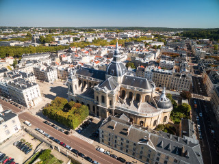
Récollets Convent was built in 1684 under the reign of Louis XIV, for the Franciscan Order, from which the convent is.
The "Récollets" was intented to serve as chaplain-bearer to the King's regiment.
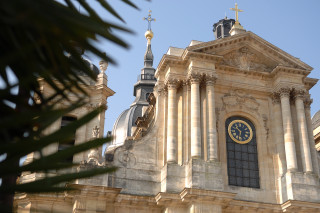
The buildings were profoundly commons, and by now it only remains the front of the church and the cloister, realised by Jules Hardouin Mansart.
After the French Revolution, the building was used as detention centre, then as infirmary for invalid persons, and finally as troop headquarters during the Empire period. From the XIX century, it is related to the French Army.
It is not open to the public, exept during specific events like the "Mois Molière" (in june, theatric event).
Pics
Pics
Tarifs
| Fares | Min | Max |
|---|---|---|
| Free | ||
We also suggest...


